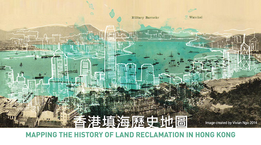

Hong Kong’s natural terrain is extremely hilly and developable land is scarce. In order for it to become a metropolitan city that it is today, numerous land reclamation projects were carried out to create buildable land. It is estimated over 35% of its developed land area has been reclaimed from the sea . These projects create huge economic, social and environmental impacts, and therefore a geodatabase would be helpful to give spatial, temporal and historic context to these projects.
This mapping application aims to provide spatial and temporal reference to these land reclamation projects that has been altering the city significantly. The story of the hidden and still changing coastline of the city will be narrated through the interfacing of geographic data and historic photos.
香港的自然地勢山多平地少, 可供發展土地本身十分有限。 從開埠以來,香港經歷多項填海造地工程,最終成為今天這個大都市, 據估計,目前已開發的土地面積超過35%是又填海所得。這些項目創造了巨大的經濟,社會和環境的影響。利用地理空間數據庫,這地圖結合空間和時間元素,再配合歷史照片,贅述香港不斷變化的海岸線故事。
©Vivian Ngo 2014
Last Updated: 8/2014

As a native of Hong Kong, my fascination with the city only grew when my family migrated to Los Angeles when I was a teenager. Years later when I am practicing as an architect designing slack skyscrapers and contemporary city experience, I value much more of the grittiness of the historic neighborhood and their vibrant community life style. Part of my effort recent has been finding ways to preserve and promote the value of the unplanned city.
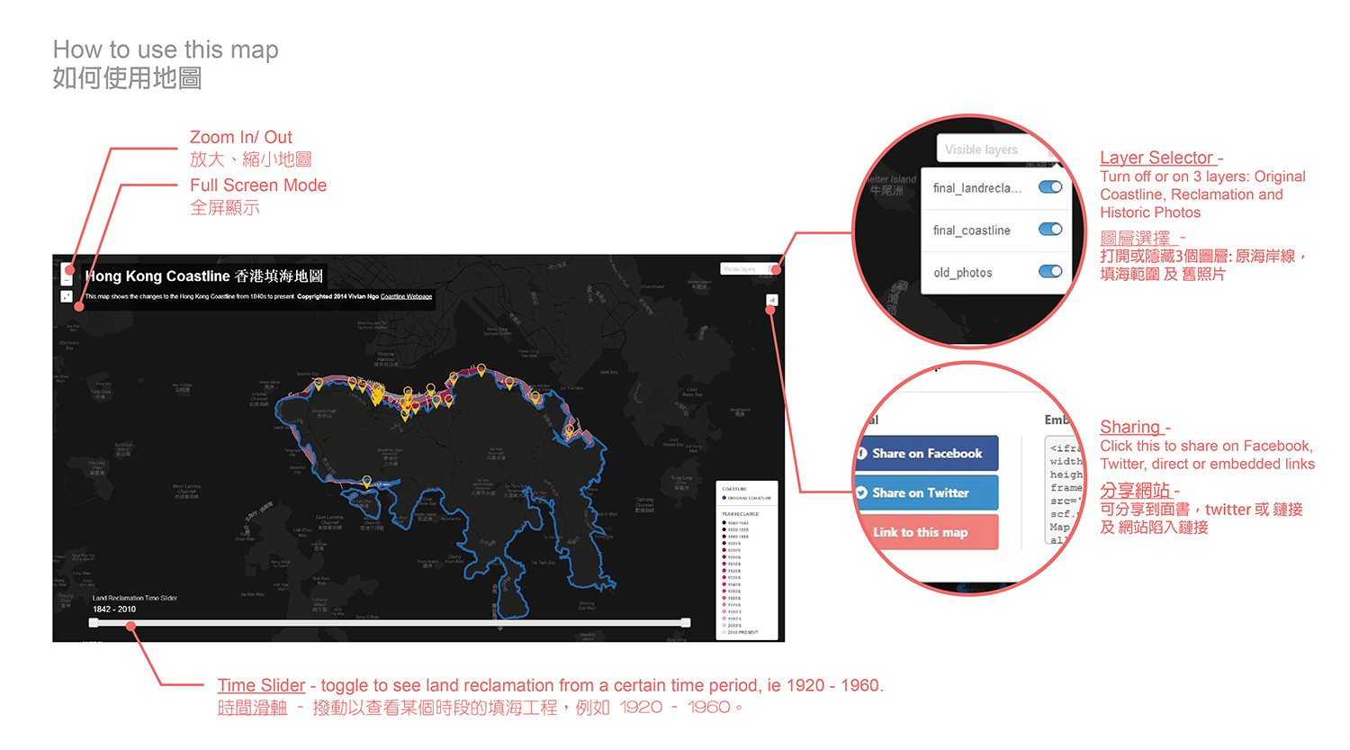
In 2013, I became part of a volunteer research team looking at the history of land reclamation projects in Hong Kong. Our goal was to publish one article about one district a month with photos, text and maps. The original post can be found in the Hong Kong Old Photo website here. The product of these articles were a series of static maps made with illustrator and AutoCAD. I then had the idea to turn these static maps into an interactive web map that allow users to use a timeline tool and toggle between layers and explore the changes to the coastline.
This project is a class project for USC's Geospatial Science Institute SSCI 591 Web GIS course. The objective of the class is to create interactive online mapping applications using open-source and proprietary software. The materials used in the project was digitized by using Google Maps Engine, and imported into CartoDB to add visualization and interactivity using its API and JavaScript library.
Contact: vivianngo@gmail.com Special Thanks to Jacky Yu, Nicky Wong, Stephen Cheung, and Cherry Fung (Hong Kong Old Photo Mapping Team)
Old Hong Kong Photo Website - photos and articles about the history of the city (In Chinese) 香港舊照片網站